Discover Our Historic Map Range
Count on our Historic Map range for reliability and premium quality.
24 hour Le Mans race 1961 Ferrari Vintage Poster (Auto Tire Racing Speedway Sports)
c1890 Map of Shenandoah Valley, showing railraods Lees of the Valley of Virginia
Societa Ferrovie Elettriche e Funicolari di Genova 1900 Vintage Travel Advertisement Poster
1924 BMW Motorcycle Vintage Bike Poster
Le Pneu Michelin 1905 Ad Vintage Poster (Auto, Tire, Racing, Speedway, Sports)
Vintage 1932 Map of United States, East Coast, North Carolina : New River Inlet - Relief shown by hachures. Depths shown by contours and soundings. - Nautical chart of New River Inlet and coastal re
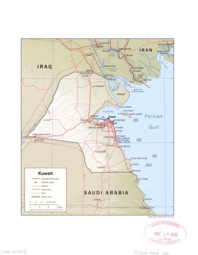
2006 Map Kuwait. - Size: 18x24 - Ready to Frame - Kuwait | Kuwait
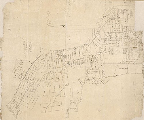
INFINITE PHOTOGRAPHS 1860s Civil War map: Landowners, Virginia Frederick County, Virginia, from Woods
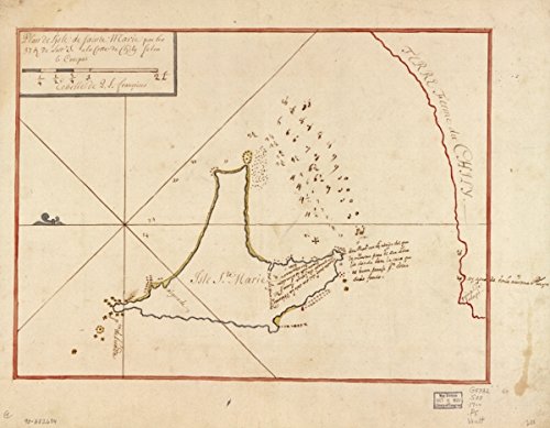
Map: 1700 Plan de l'isle de Sainte Marie par les 37 g. de lattd. S. à la cotte du Chily selon le compas|Chile|Coasts|Manuscript s|Pacific Coast|Pacific Coast Chile|Santa Maria Island Biobio|Santa Marí
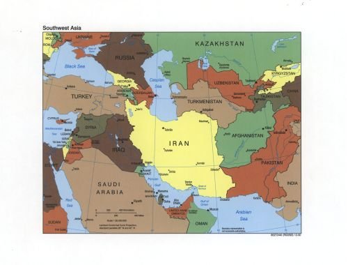
INFINITE PHOTOGRAPHS 2000 Map Southwest Asia. - Size: 18x24 - Ready to Frame - Middle East | Middle East
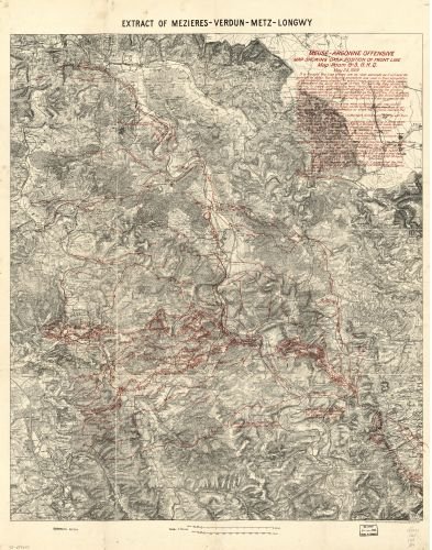
Map of Meuse-Argonne Offensive, Showing Daily Position of Front line : Room G-3, G.H.Q, May 24, 1919. Argonne|France|Argonne|France|Argonne|Argonne, Battle of The, France|Campaigns|France|World War
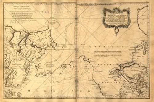
Map of L'hydrographie françoise : recueil des cartes générales et particulières qui ont éte faites pour le service des vaisseaux du roy, par ordre des Ministres de la marine, depuis 1737, jusqu'en 176
Vintage 1715 Map of A map of the West-Indies or the islands of America in the North Sea; with ye adjacent countries; explaning [sic] what belongs to Spain, England, France, Holland, &c. also ye trade winds, and ye several tracts made by ye galeons and flota from place to place. Caribbean Area, West Indies
Vintage 1805 Map of Map of Manchac and Baton Rouge District, Spanish West Florida Baton Rouge, East Baton Rouge Parish, Louisiana, Lousiana, Manchac, United States
Vintage 1805 Map of Plat of the concessions to Manuel Gayoso de Lemos in Baton Rouge District, Spanish West Florida East Baton Rouge Parish, Louisiana, Lousiana, United States
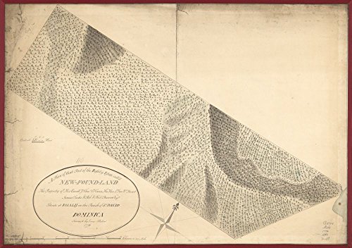
Vintage 1776 Map of that part of the Rosalij Estate call'd New-Found-Land, the property of His Excellcy. Chas. O'Harra, the Hon. Lt. Gov. Wm. Stuart, James Clarke & Rob. & Phill. Browne, Esqrs., situate at Rosalij in the parish of St. David, Dominica. Dominica, Rosalie Region
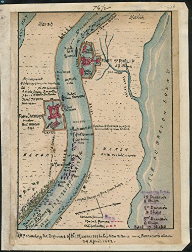
Vintage 1861 to 1862 Map of defenses of the Mississippi below New Orleans and Farragut's attack 24 April 1862. Map shows the Confederate fortifications at Fort Jackson under Gen. Duncan, Fort St. Philip and the Union fleet along the Mississippi River. This map, also shows the positions of Union ships under Farragut, who captured the strategic port of New Orleans, thereby providing the Federal army access to the Mississippi River. Fort Jackson, Fort Jackson Region, Louisiana, Lousiana, New Orlean
INFINITE PHOTOGRAPHS 2006 map Aegean Sea Region|Size 22x24 - Ready to Frame| Aegean Sea Region|Cyprus|Greece|Turkey
1854 map of Hokkaido, Japan & Sakhalin, Russia Ezo kokyo yochi zenzu. Tonsai Fuj
Vintography 1760 Map A map of The Land of Canaan or Holy Land, as Divided Among The Twelve Tribes which God Prom


![Vintage 1715 Map of A map of the West-Indies or the islands of America in the North Sea; with ye adjacent countries; explaning [sic] what belongs to Spain, England, France, Holland, &c. also ye trade winds, and ye several tracts made by ye galeons and flota from place to place. Caribbean Area, West Indies](https://images-na.ssl-images-amazon.com/images/I/71Fgk1OU3UL.jpg)