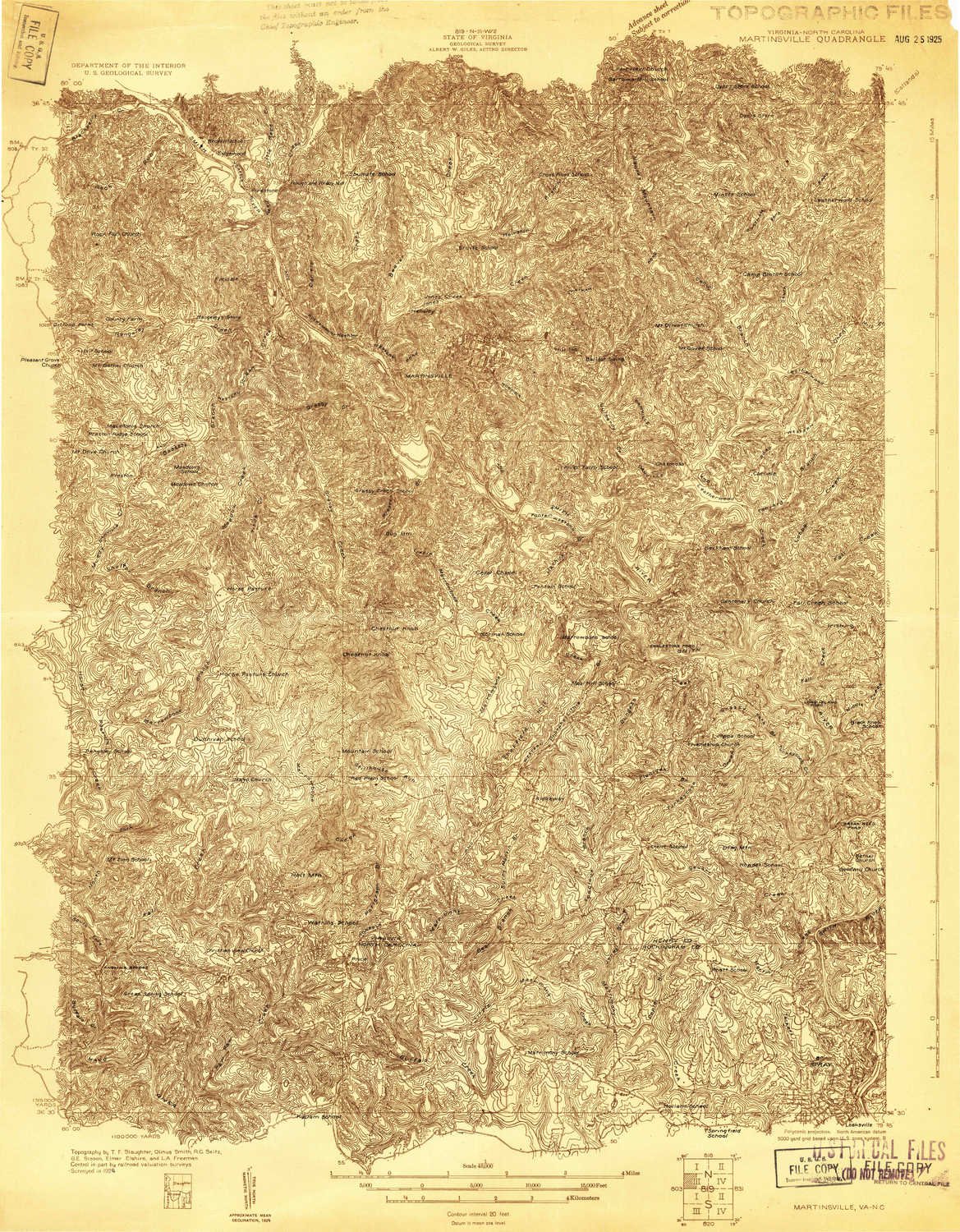
USGS topographic map of Martinsville, Virginia, dated 1924.Includes geographic coordinates (latitude and longitude), lines of elevation, bodies of water, roads, and more. This topo quad is suitable for recreational, outdoor uses, office applications, or wall map framing.Printed on-demand by YellowMaps on the print material of your choice.Shipping rolled from Minneapolis, MN, United States.Product Number: USGS-5659806Map Size: 27.8 inches high x 21.7 inches wideMap Scale: 1:48000Map Type: POD USGS Topographic MapMap Series: HTMCMap Version: HistoricalCell ID: 57242Scan ID: 187713Survey Year: 1924Datum: NADMap Projection: PolyconicAdvance: YesMap published by United States Geological SurveyKeywords: Nonstandard Press Run; OveredgeMap Language: EnglishScanner Resolution: 600 dpiMap Cell Name: MartinsvilleGrid size: 15 X 15 MinuteDate on map: 1924Geographical region: Virginia, United StatesNorthern map edge Latitude: 36.75°Southern map edge Latitude: 36.5°Western map edge Longitude: -80°Eastern map edge Longitude: -79.75°Surrounding map sheets (copy & paste the Product No. in the search bar):North: USGS-5303358,USGS-5296407,USGS-5659864,USGS-5303364,USGS-5303362East: USGS-5372386,USGS-5302814,USGS-5372390,USGS-5302818,USGS-5302816South: USGS-5374808,USGS-5371876,USGS-5371878West: USGS-5302778,USGS-5373478,USGS-5303656,USGS-5302780,USGS-5659746
Trustpilot
2 weeks ago
1 day ago
