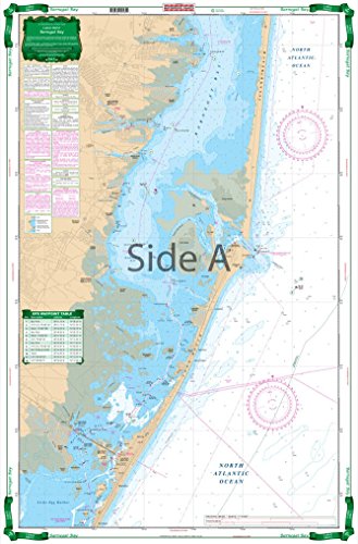
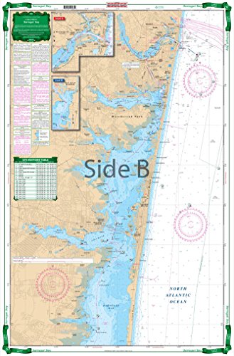
This large print chart covers the Manasquan Inlet Bay Head, the Metedconk River, and the Toms River areas. Provides coastal coverage up to 4 miles offshore. This chart includes 31 sets of plotted GPS coordinates on the chart. Information from NOAA chart #12324. Chart is 25" X 38". WGS84 - World Mercator Datum.
Trustpilot
4 days ago
1 month ago
