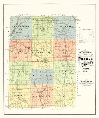
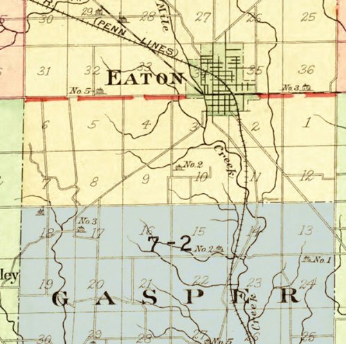
PREBLE COUNTY OHIO (OH) OUTLINE MAP 1912This is an exquisite full-color Reproduction printed on Matte Bright Canvas. These maps are perfect for framing, or a wonderful and unique gift for family members, friends or co-workers!All Information is Carefully Compiled from Actual SurveysOriginal Maps are often difficult to find and usually have fold lines, identifying stamps or markings, tears, ragged edges, and assorted other natural signs of age that detract from their beauty. All of our maps have been professionally restored to depict their original beauty, while keeping all historical data intact.These maps are fabulous pieces of history full of information useful to Historians, Genealogists, Cartographers, Relic Hunters, & Others. They make fascinating conversation pieces and splendid works of art for the home or office.Print Size: 23.00 x 27.32 inchesSites and Townships Specific To This Map Are: Townships as indicated in 1912: Jefferson, Monroe, Harrison, Jackson, Washington, Twin, Dixon, Gasper, Lanier, Israel, Somers, and Gratis. P.C.C. & St. Louis Railroad, Ohio Electric Railroad, New York Central Lines, Prices Creek, Four Mile Creek, Rush Run, and New Hope Station.The following towns are featured: New Paris, Hagerstown, Gettysburg, Lewisburg, Eaton, Camden, Gratis, Fair Haven, and College Corner.This Map is Situated in: Preble County, Ohio.SKU: OHPR0001-4
Trustpilot
2 months ago
2 days ago
