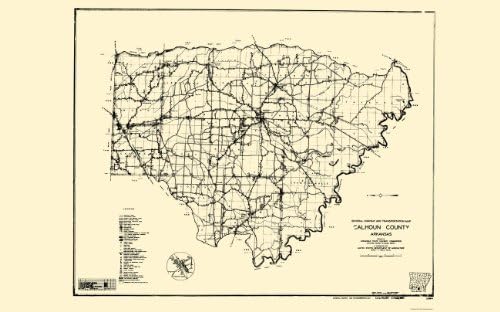
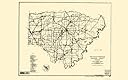
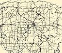
Old County Maps - CALHOUN COUNTY ARKANSAS (AR) MAP BY STATE HWY COMM. 1936 - Matte Bright Canvas
Desertcart purchases this item on your behalf and handles shipping, customs, and support to Belgium.
Description
- Free Freight
- Fast Delivery
- Giclee Printing
- 23.00 x 36.92 inches
CALHOUN COUNTY ARKANSAS (AR) MAP BY STATE HWY COMM. 1936This is an exquisite full-color Reproduction printed on Matte Bright Canvas. These maps are perfect for framing, or a wonderful and unique gift for family members, friends or co-workers!All Information is Carefully Compiled from Actual SurveysOriginal Maps are often difficult to find and usually have fold lines, identifying stamps or markings, tears, ragged edges, and assorted other natural signs of age that detract from their beauty. All of our maps have been professionally restored to depict their original beauty, while keeping all historical data intact.These maps are fabulous pieces of history full of information useful to Historians, Genealogists, Cartographers, Relic Hunters, & Others. They make fascinating conversation pieces and splendid works of art for the home or office.Print Size: 23.00 x 36.92 inchesSites and Townships Specific To This Map Are: Artesian, Delhi, Hampton, Harrell, Summerville, Tinsman, Woodberry, Smead, Locust, Elberta, Ellisville, Levit, Chambersville, Alberta, Thornton, Hopeville, Harlow, and others.The following towns are featured: Waterways shown include Grapevine Lake, Moro Bayou, Hurricane Creek, Ouachita River, Champagnolla Creek, and other smaller creeks and tributaries. The standard legend for the state is included and an inset for Thornton.This Map is Situated in: State of Arkansas (AR).SKU: ARCA0001-4
Common Questions
Trustpilot