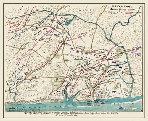
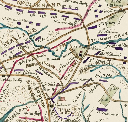
SHILOH BATTLEFIELD TENNESSEE (TN) CIVIL WAR MAP 1862This is an exquisite full-color Reproduction printed on Glossy Satin Paper. These maps are perfect for framing, or a wonderful and unique gift for family members, friends or co-workers!All Information is Carefully Compiled from Actual SurveysOriginal Maps are often difficult to find and usually have fold lines, identifying stamps or markings, tears, ragged edges, and assorted other natural signs of age that detract from their beauty. All of our maps have been professionally restored to depict their original beauty, while keeping all historical data intact.These maps are fabulous pieces of history full of information useful to Historians, Genealogists, Cartographers, Relic Hunters, & Others. They make fascinating conversation pieces and splendid works of art for the home or office.Print Size: 23.00 x 28.11 inchesSites and Townships Specific To This Map Are: Scene of Battle, usually called Shiloh from a nearby church, April 6-7, 1862 in which confederates under General Albert Sidney Johnson made a successful attack on Grant's union forces, who however, with fresh reinforcements, finally compelled confederate withdrawal. Tennessee River, Tillman's Creek, Snake Creek, Lick Creek.The following towns are featured: Pittsburg LandingThis Map is Situated in: Hardin County, Tennessee.SKU: CWSH0001-2
Trustpilot
2 months ago
2 weeks ago
