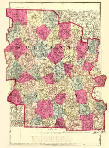
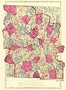
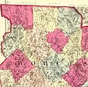
Old County Maps - WORCESTER MASSACHUSETTS (MA) COUNTY MAP BY H.F. WALLING 1871 - Matte Art Paper
Product ID: 30726192
Desertcart purchases this item on your behalf and handles shipping, customs, and support to Belgium.
WORCESTER MASSACHUSETTS (MA) COUNTY MAP BY H.F. WALLING 1871This is an exquisite full-color Reproduction printed on Matte Art Paper. These maps are perfect for framing, or a wonderful and unique gift for family members, friends or co-workers!All Information is Carefully Compiled from Actual SurveysOriginal Maps are often difficult to find and usually have fold lines, identifying stamps or markings, tears, ragged edges, and assorted other natural signs of age that detract from their beauty. All of our maps have been professionally restored to depict their original beauty, while keeping all historical data intact.These maps are fabulous pieces of history full of information useful to Historians, Genealogists, Cartographers, Relic Hunters, & Others. They make fascinating conversation pieces and splendid works of art for the home or office.Print Size: 23.00 x 31.16 inchesSites and Townships Specific To This Map Are: Royalston, Winchendon, Athol, Phillipston, Templeton, Gardner, Ashburnham, Fitchburg, Westminster, Leominster, Lunenburg, Princeton, Harvard, Bolton, Clinton, Sterling, Berlin, Boylston, North Borough, South Borough, West Borough, Shrewsbury, Grafton, Upton, Millbury, Sutton, North Bridge, Uxbridge, Blackstone, Mendon, Douglas, Werster, Dudley, South Bridge, Charleton, Oxford, Sturbridge, Auburn, Brookfield, Spencer, Oakham, Warren, New Braintree, Hardwick, Paxton, Barre, Dana, and Petersham.The following towns are featured: Baptist Church, Ponds (ex. Long Pond, New Boston Pond, Cooks Pond and many more), Brooks (ex. Laurence Brook, Phllips Brook, Fever Brook and many more), Railroads (ex. Vermont and Massachusetts Railroad, Cheshire Railroad, Boston and Albany Railroad and many more), Rivers (ex. Miller's River, Otter River, Ware River and many more), Villages (ex. Blackburn Village, Whitman Village, Mill Village and many more), Hills (ex. Pearl Hill, Be
Trustpilot
2 weeks ago
1 month ago