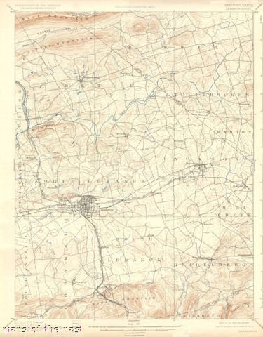
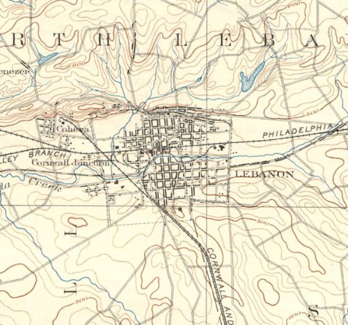
LEBANON QUAD PENNSYLVANIA (PA) USGS 1899This is an exquisite full-color Reproduction printed on Matte Bright Canvas. These maps are perfect for framing, or a wonderful and unique gift for family members, friends or co-workers!All Information is Carefully Compiled from Actual SurveysOriginal Maps are often difficult to find and usually have fold lines, identifying stamps or markings, tears, ragged edges, and assorted other natural signs of age that detract from their beauty. All of our maps have been professionally restored to depict their original beauty, while keeping all historical data intact.These maps are fabulous pieces of history full of information useful to Historians, Genealogists, Cartographers, Relic Hunters, & Others. They make fascinating conversation pieces and splendid works of art for the home or office.Print Size: 23.00 x 29.44 inchesSites and Townships Specific To This Map Are: Townships of Bethel, Tilpehocken, Swatara, Lebanon, Jackson, Mill Creek, Cornwall, Annville, Blue Mountain, Monroe Valley, Little Mountain, Bunker Hills, Blackoak Ridge, Mount Ararat, Little Swatara Creek, Beck Creek, Hammer Creek, Philadelphia & Reading Railroad, R&R Railroad (Lebanon Branch), Cornwell & Lebanon Railroad and Crosskill Mill.The following towns are featured: Bethel, Mount Etna, Jonestown, Myerstown, Lebanon, Richland, Bismarck and Fredericksburg.This Map is Situated in: Schuylkill, Berks, Lebanon, Lancaster County, Pennsylvania (PA)SKU: PALE0001-4
Trustpilot
2 months ago
1 month ago
