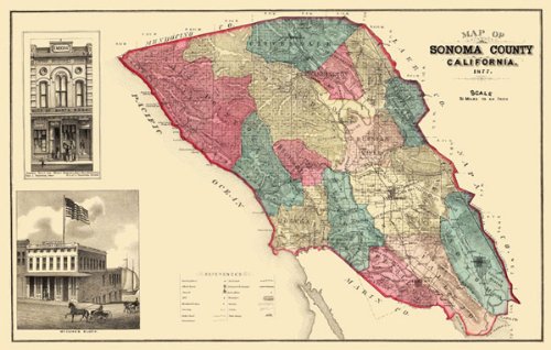
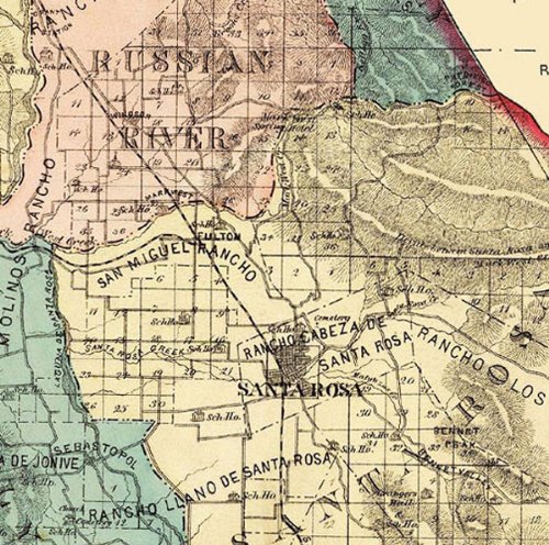
SONOMA COUNTY CALIFORNIA (CA/SANTA ROSA) MAP 1877This is an exquisite full-color Reproduction printed on Matte Art Paper. These maps are perfect for framing, or a wonderful and unique gift for family members, friends or co-workers!All Information is Carefully Compiled from Actual SurveysOriginal Maps are often difficult to find and usually have fold lines, identifying stamps or markings, tears, ragged edges, and assorted other natural signs of age that detract from their beauty. All of our maps have been professionally restored to depict their original beauty, while keeping all historical data intact.These maps are fabulous pieces of history full of information useful to Historians, Genealogists, Cartographers, Relic Hunters, & Others. They make fascinating conversation pieces and splendid works of art for the home or office.Print Size: 23.00 x 36.59 inchesSites and Townships Specific To This Map Are: Original Townships of: Cloverdale, Petaluma, Salt Point, Vallejo, Mendocino, Sonoma, Washington, Knights Valley, Russian river, Ocean, Redwood, Santa Rosa, Cranes Peak, Black Mountain, Bennet Peak, Sonoma Valley, Bennet Valley, Duncan Mills, Dry Creek, Big Sulphur Creek, Russian River, False Bay, San Antonio Creek, School Houses Located & Forestville Post Office.The following towns are featured: Sonoma, Cloverdale, Healdsburg, Mercuryville, Fulton, Petaluma & Sebastolpol.This Map is Situated in: Sonoma County, California.SKU: CASO0002-3
Trustpilot
1 month ago
2 months ago
