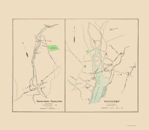
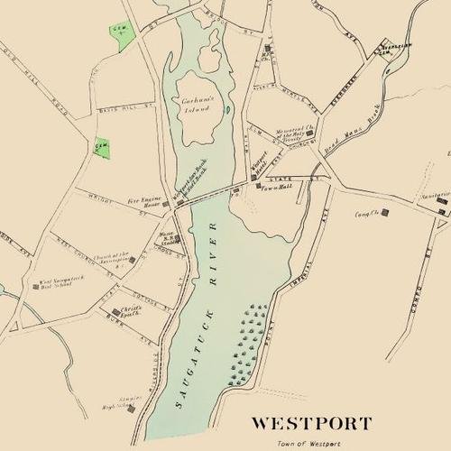
WESTPORT/SANDY HOOK/ROCKY GLEN CONNECTICUT (CT) CITY MAP BY HURD 1893 This is an exquisite full-color Reproduction printed on Glossy Satin Paper. These maps are perfect for framing, or a wonderful and unique gift for family members, friends or co-workers! All Information is Carefully Compiled from Actual Surveys Original Maps are often difficult to find and usually have fold lines, identifying stamps or markings, tears, ragged edges, and assorted other natural signs of age that detract from their beauty. All of our maps have been professionally restored to depict their original beauty, while keeping all historical data intact. These maps are fabulous pieces of history full of information useful to Historians, Genealogists, Cartographers, Relic Hunters, & Others. They make fascinating conversation pieces and splendid works of art for the home or office. Print Size: 23.00 x 26.44 inches Sites and Townships Specific To This Map Are: Newtown, Westport, Sandy Hook, and Rocky Glen. The following towns are featured: many labeled streets, Naugatuck River, Brooks (ex. Dead Man's Brook, Pootatuck Brook), Cemeteries (ex. Evergreen Cemetery, St. Rose R.C. Cemetery), Gorham's Island, Westport Waterworks Stand Pipe, Churches (ex. Memorial Church of the Holy Trinity, Congregational Church, Episcopal Church), Schools (ex. Sandy Hook School, Pootatuck School, Staples High School), Sanitarium, Town Hall, Westport Hotel, Westport Savings Bank, Fire Engine House, Horse Railroad Stables, and Sandy Hook Station. This Map is Situated in: Fairfield County, Connecticut (CT) SKU: CTWE0004-2
Trustpilot
2 months ago
4 days ago
