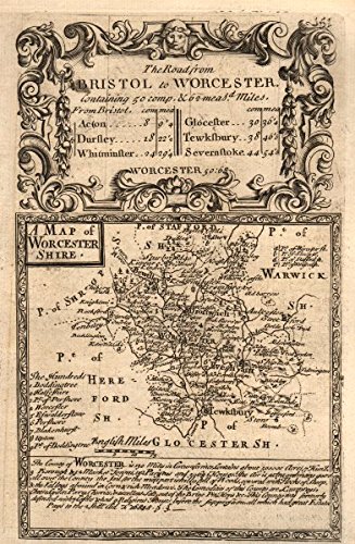

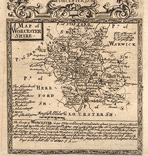
Antique Map: 'A Map of Worcester-Shire'. County map by OWEN & BOWEN. Worcestershire. Title: 'A Map of Worcester-Shire'. Type: Antique copperplate county map. Date of printing: 1753. Size: 12.5 x 19.0cm, 5 x 7.5 inches (Medium), 253 sq cm. Artist, cartographer or engraver: John Owen & Emmanuel Bowen. Condition: Good; suitable for framing. However, please note: The image shown may have been taken from a different example of this map than that which is offered for sale. The map you will receive is in good condition but there may be minor variations in the condition from that shown in the image. Please check the scan for any blemishes prior to making your purchase. Verso: This sheet is printed on both sides of the page. Plate number 151 is shown. Plate number 152: [Bristol-Winterbourne-Rangeworthy-Dursley-Whitminster] is printed on the reverse side. The printing on the reverse side may show through to the front to some extent.. Provenance: "Britannia Depicta or Ogilby Improv'd; Being a Correct Coppy of Mr. Ogilby's Actual Survey of all ye Direct & Principal Cross Roads in England and Wales…" by John Owen, with maps by Emmanuel Bowen. Printed & sold by Thomas Bowles, print & map seller in St Pauls Churchyard. 1753. The fourth edition [Britannia Depicta]. Subject categories: Worcestershire Owen Bowen.
Trustpilot
2 months ago
1 month ago
