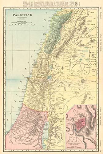

Antique Map: PALESTINE Holy Land Israel Lebanon Syria Jordan Jerusalem. RAND MCNALLY. Title: 'Palestine, inset Modern Jerusalem and Environs'. Type: Antique colour (color) atlas map. Date of printing: 1906. Size: 51.0 x 34.0cm, 20 x 13.5 inches (Large), 1758 sq cm. Artist, cartographer or engraver: Rand McNally. Condition: Good; suitable for framing. However, please note: This map was originally printed as two separate pages which have been professionally joined to form a single sheet. Please check the scan for any blemishes prior to making your purchase. Verso: There are images and/or text printed on the reverse side of the picture. In some cases this may be visible on the picture itself (please check the scan prior to your purchase) or around the margin of the picture. Provenance: "Rand Mc Nally's Unrivaled Atlas", Rand McNally, Chicago & New York, USA. Subject categories: Israel Rand McNally.
Trustpilot
1 week ago
1 day ago
