Classroom Complete Press CC7773 Mapping Skills With Google Earth Big Box - Paul Bramley
Desertcart purchases this item on your behalf and handles shipping, customs, and support to Belgium.
Description
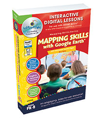
- Classroom Complete Press CC7773 Mapping Skills With Google Earth Big Box - Paul Bramley
- UPC:NULL
Explore the concepts of mapping skills with your students with our engaging and highly interactive 240 screen-page digital lesson plan for grades prekindergarten to eight. Combining the 3 lessons in this series, our program teaches the skills of map reading starting with the basics to the more advanced. We start by highlighting the elements of map reading from symbols and the compass rose to lines of latitude, longitude and time zones. Students will learn the basics of map reading, starting with a general overview of the continents and countries, then becoming more specific with topographic and choropleth maps. Using any brand of Interactive White-board, you will be able to create an opportunity for students to get more involved in the lesson. Each ready-made screen contains reading passages, before and after you read interactive activities, a Google Earth component, interactive map activities, test prep, memory match game, crossword, word search, printables, supporting video, and even English and Spanish Text to Speech. Test your student's comprehension of the lesson with a Comprehension Quiz by using smart Notebook software's assessment tool, smart response. All of our content is aligned to your State Standards and are written to Bloom's Taxonomy.FeatureTitle - Mapping Skills with Google Earth Big Box.Reading Level - PK-8.Screen Pages - 240.Digital lesson plans.Author - Paul Bramley.Dimension - 9.75 x 1.25 x 6.5 in.
Common Questions
Trustpilot