Uncover the Latest Jolly Map Innovations
Find your favorites among our trusted selection of Jolly Map must-haves.
National Geographic Road Atlas 2025: Adventure Edition [United States, Canada, Mexico] Spiral-bound – June 10, 2024
United State Map Laminated Poster -Double Side Educational Poster For Kids/Adults -18 x 24 inch Waterproof Map For Home Classroom
Uttar Pradesh Map | English | Laminated | 100 x 70 cm Wall Chart – 8 January 2022
Jolly RancherHard Candy Original Single Pack 198g
The Jolly Hog Black Pudding Porker
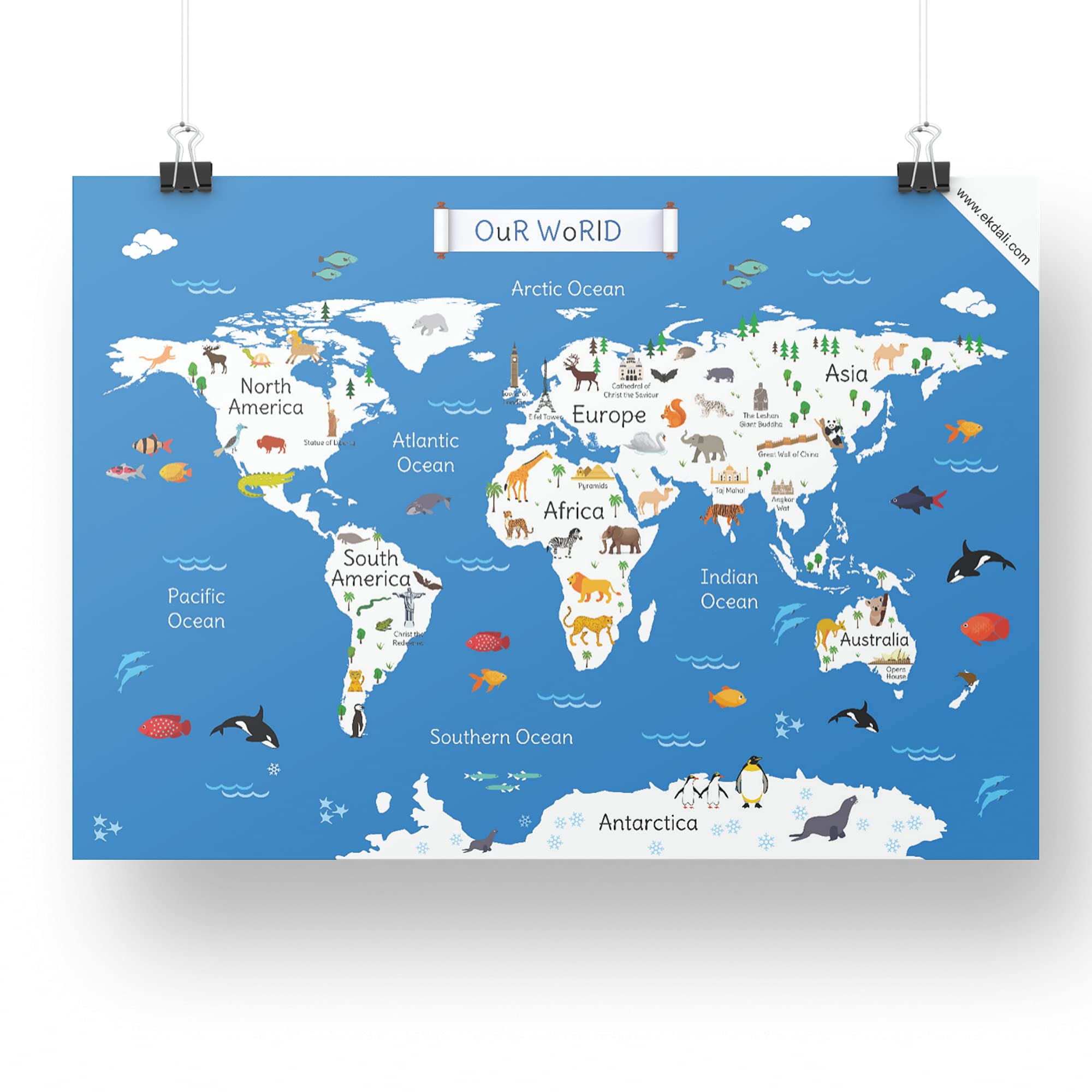
ekdali world map kids | Famous animal |Classroom Home Room Decor (Multi,11.7X16.5 Inches)
Stupell IndustriesJolly Map Of North Pole Framed Floater Canvas Wall Art, Design by Irene Chan
National Geographic: The World for Kids Wall Map - Laminated (36 x 24 inches) (National Geographic Reference Map)
World Map and USA Map for Kids - 2 Poster Set - LAMINATED - Wall Chart Poster of the United States and the World (18 x 24)
Frank India Map (108 Pieces) - Early Learner Jigsaw Puzzle Set with States, Union Territories, Capitals for Kids 6 Years and Above - Educational Toys and Games -10149
World Map Laminated Poster -Double Side Educational Poster For Kids/Adults -18 x 24 inch Waterproof Map For Home Classroom
Lonely Planet Kids Let's Explore... Jungle
India Map : Political | Laminated Both Sides | 70 x 100 cm ( Big Map )
National Geographic Kids Physical USA Education: Grades 4 - 12 Wall Map - Laminated (51 x 40 in) (National Geographic Reference Map)
National Geographic United States for Kids in gift box Wall Map (Poster Size: 36 x 24 in) (National Geographic Reference Map)
United States Map - USA Poster, US Educational Map - with State 2 Letter Abbreviation - for Ages Kids to Adults- Home/School/Office- Printed on 110Lb Card Stock - 12" x 18" Inches - Bulk Pack of 10
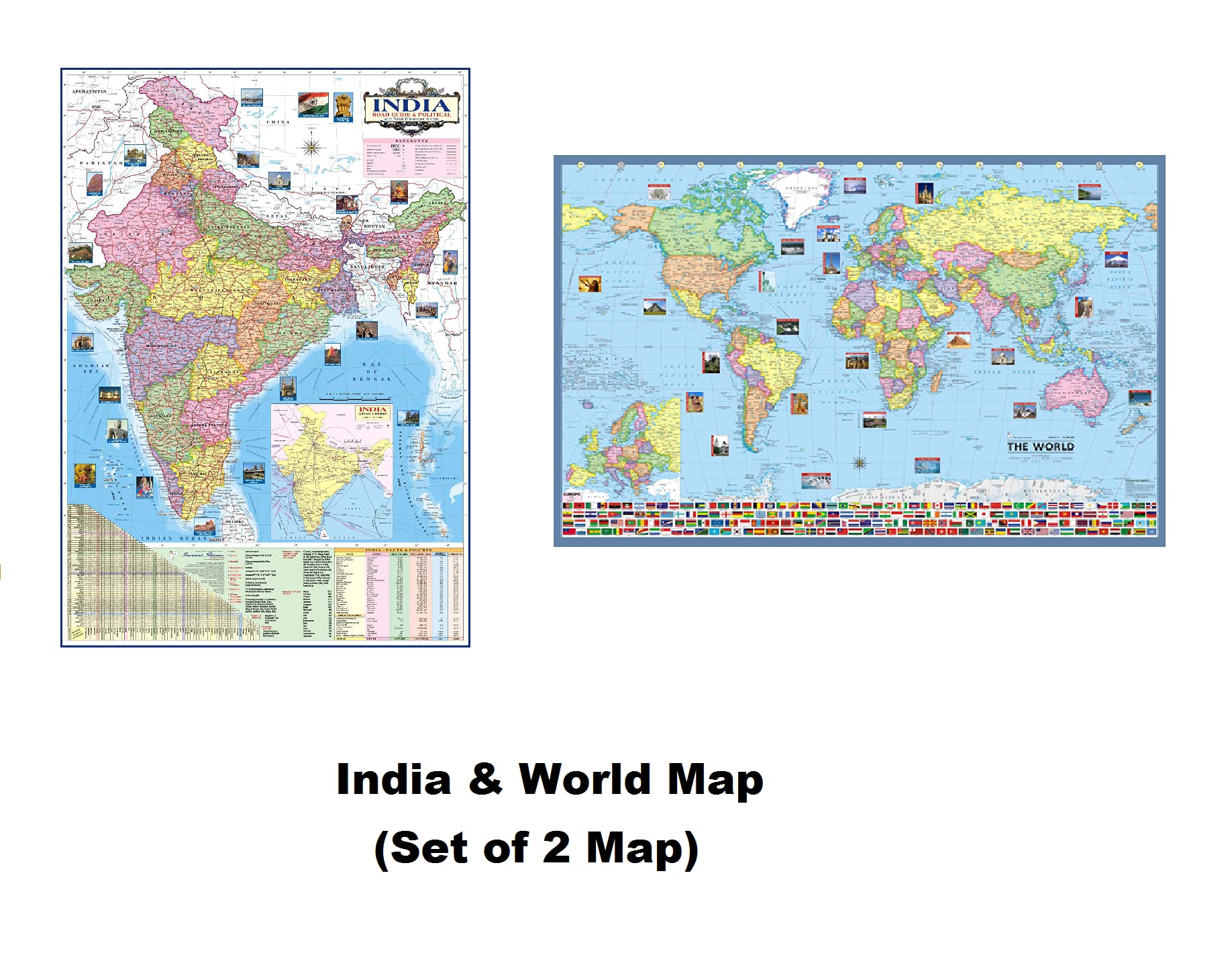
INDIA & WORLD Political Map (Pack of 2) (Both Map Size 100x70 Centimeter) In India Map Mention Distance Between Major Cities and Highway, Rivers, Peaks, Capital, Area, Density, Literacy of States Etc. Map – 1 January 2020
National Geographic Kids Beginners World Education: Grades K - 3 Wall Map - Laminated (51 x 40 in) (National Geographic Reference Map)
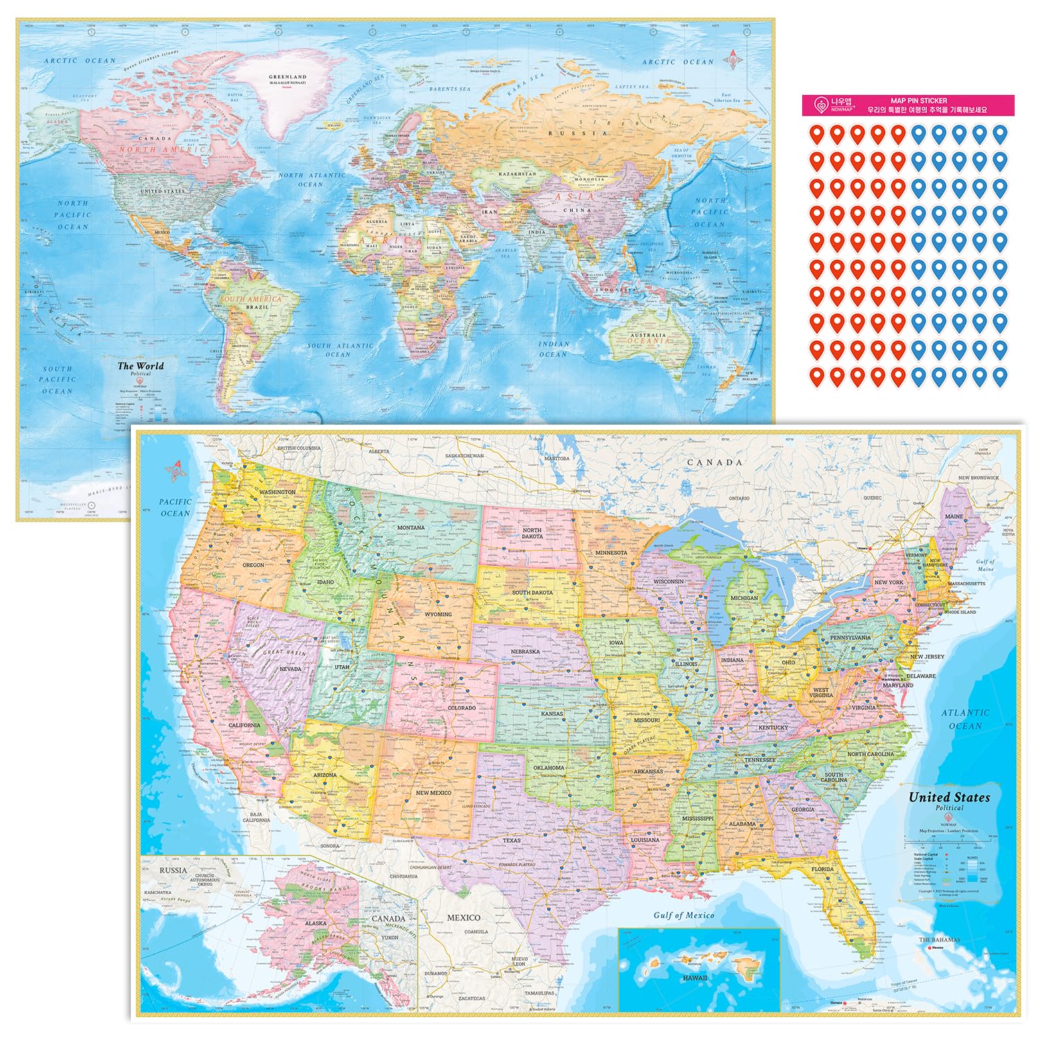
NOWMAP AquaShield Double-Sided World and USA Map Waterproof Tow Wall Map Set 24x36 - Folded Edition with (Pin Stickers)
USA Map for Kids - United States Wall/Desk Map (18" x 26" Laminated)
Waypoint Geographic Kids’ USA Wall Map, Laminated Wall Map Poster for Kids, Informative Learning Resources, Illustrated Wall Map for Playroom and Classroom Decor, 24" x 36"
Vintage Treasure Map For Kids, Pirate Birthday Party Supplies (12x18 In, 12 Pack)
Kids' Illustrated Map of the World
United States Map - USA Poster, US Educational Map - With State Capital - for Ages Kids to Adults - Home School Office - Printed on 12pt. Glossy Card Stock | Bulk Pack of 10 |11 x 17 Inches
Beistle Plastic Pirate Treasure Map 3 Piece Party Accessories Game Favors Birthday Decorations
United States (USA) Map with State Flags for Kids (36" x 24" Laminated)

![National Geographic Road Atlas 2025: Adventure Edition [United States, Canada, Mexico] Spiral-bound – June 10, 2024](https://m.media-amazon.com/images/I/81rRihqWqgL.jpg)